Today was probably the longest day of the trip on the road both in time and mileage. I left the hotel in Alton, IL around 8:30 am and some 370 miles later arrived in Dubuque, IA about 5:40 pm. Again the poor planning had me crossing the border back into Iowa for the night as I didn’t look closely enough at the map. As I was passing through Galena, IL I spotted several hotels. Not a big deal, as it’s no more than five miles back to get on track in the morning.
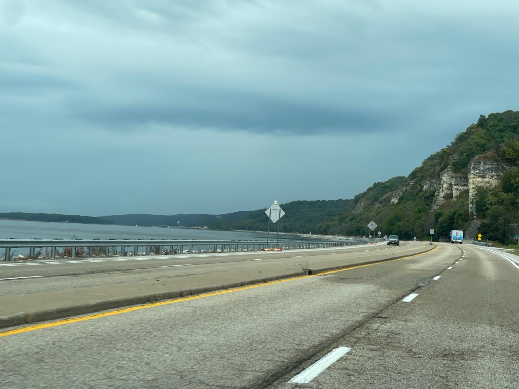
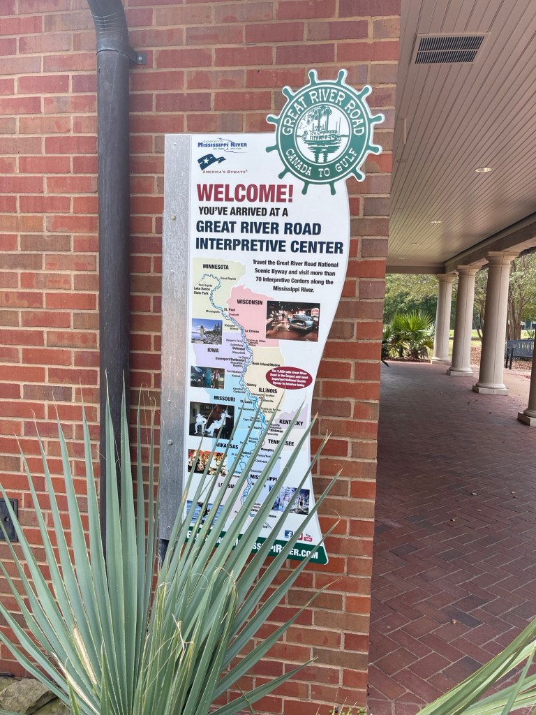
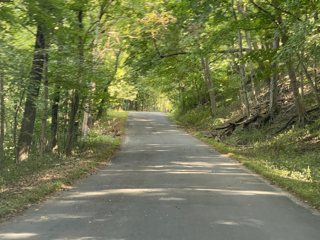
It was a long drive up the western side of Illinois, but I have to say it is one of the best stretches of the road in terms of utilizing what is available. There were several stretches that were literally right on the river bank. Additionally, there were numerous “info” stops along the way. Rest stops without any services but with historical context about the area and some of them with scenic views as well. No other state so far has provided this. Thumbs up Illinois!
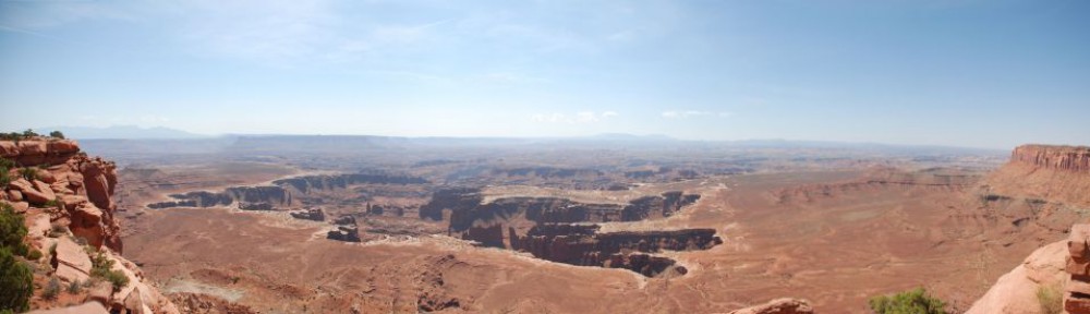
Additionally, this stretch of the road was quite scenic. Back into some hilly, winding roads, through both farmlands and forested areas. A very enjoyable drive, if a bit on the long side.
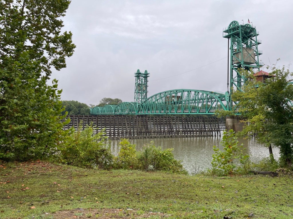
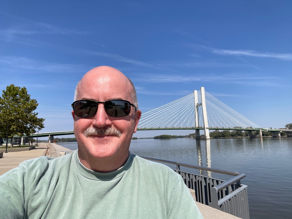
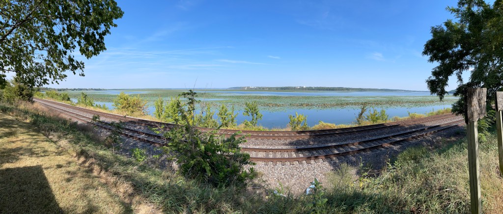
Along the river bankA bridgeAlong the river bankScenic stop
Tomorrow is the last day of the trip and will take me up along the Wisconsin side of the river. I’m expecting it to be a good conclusion to the trip. Certainly ready to get home!
To be honest the last couple of days have been a slog. A couple of long boring days on the road, highlighted only by the visit to the Vicksburg National Military Park. Today’s plan is to get to Alton, IL, just on the north side of St. Louis – on the Illinois side of the river of course.
Just a few blocks from the hotel I stayed was a Cracker Barrel, so since I missed it yesterday, that’s where I started my day. Was a good choice to take some time since it was raining quite heavily and would rather avoid driving in that. So had my breakfast and filled up with coffee and the rain had stopped. Topped off with gas and was on my way. Dang it – that’s twice now I’d forgotten to clean my windshield!
Coming into Dyersburg yesterday I had by-passed the actual route about 15 miles south of town as I wanted to get settled in. So the drive started with a bit of backtracking to the south to get back onto the Great River Road. So worth it! I think. It was backroads along the levee and across a bayou, but the views were obstructed for a portion as it started raining again. Heavily! Good news – my windshield is nice and clean!
Was a nice drive through this portion of Tennessee and there was a nice pull over at a ferry crossing and the rain had stopped for a few minutes. I took the opportunity to fly the drone and get a few shots. From there it was onwards toward Kentucky.
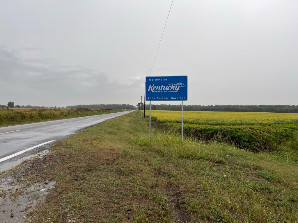
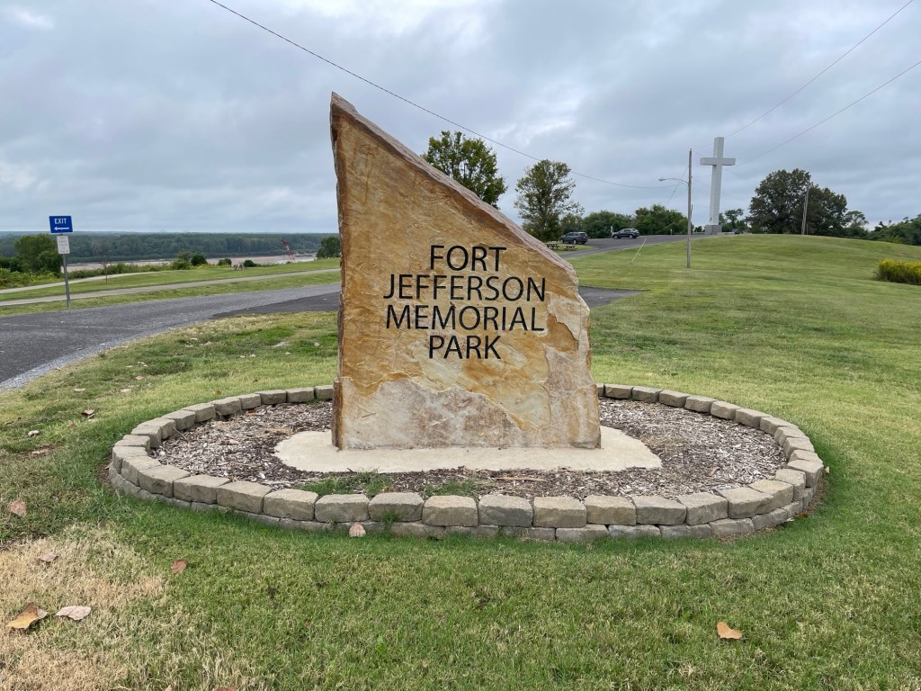
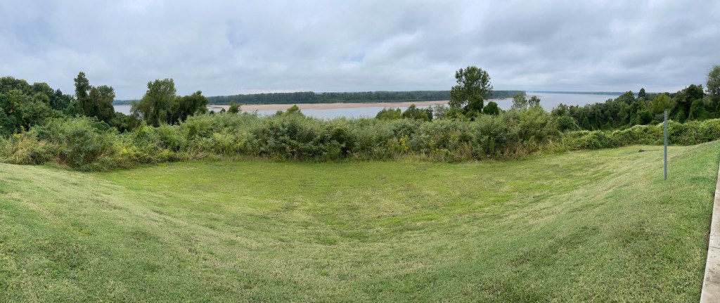
The route entered into Kentucky and presented a lot of nice roads and scenery. It’s quite a short section of the route through the western tip of Kentucky but worth it. I stopped at a scenic overlook in Wickliffe, KY that was the site of the Revolutionary War site called Fort Jefferson. I actually had no idea, or at least recollection, that there was any related activity this far west during that war. But it turns out there were several battles\skirmishes with American victories that led to the US acquiring these territories in the treaty that ended the war. Know you know!
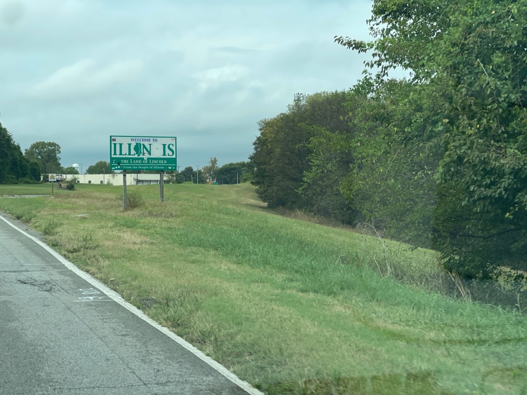
Shortly north of Wickliffe, the route crosses the Ohio river into Illinois and the town of Cairo – namesake of the U.S.S. Cairo mentioned yesterday from the Vicksburg National Military Park. From here I would follow Illinois state highway 3 all the way to the southern edge of St. Louis. Highway 3 offered a lot of nice scenery and was a good drive. Highway 3 would continue directly through East St. Louis. however as it was getting late in the day and was pretty much rush hour I had no idea how long it would take to go through. Therefore I opted to take the Interstate around East St. Louis. Made it to the hotel in Alton about 5pm, so it had been a good 8 hours on the road with only a couple of quick breaks along the way.
After settling in at the hotel I did a little sleuthing for someplace to eat in Alton and came across The Old Bakery Beer Company. It’s a casual craft brewery with lots of good selections and an interesting menu. I tried their Golden Oat and Dreamin’ for a Cure beers and both were amazing. For eats I had their Harvest Grain salad which was also delicious! From there back to hotel to write this up and crash!
Today was a much better day on the road and I think the next two should be good as well so long as this side of the river corresponds well to the western side of the first couple of days.
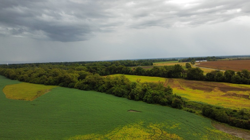
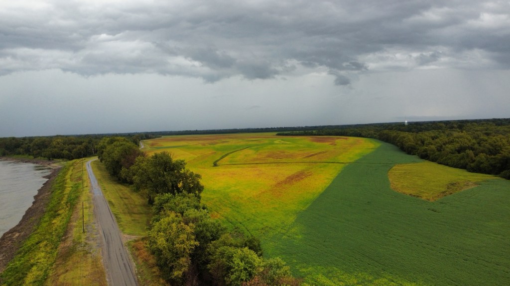
Near Tiptonville, TNNear Tiptonville, TNWelcome to KentuckyFort Jefferson, Wickliffe, KYWickliffe, KYSeriously, IL – do better!
Today’s drive took me from Vicksburg, MS to Dyersburg, TN. Was a little trouble getting on the road… Left the hotel early as I was just going to stop somewhere on my way out of Vicksburg and also top off with gas. Initially went wrong way out of the motel parking lot and so had to backtrack a bit to get back on US-61. No big deal. Got on the road and then saw a sign for a Cracker Barrel and as I hadn’t been to one of those in ages, I thought perfect. Took the exit, sign says one mile straight ahead. OK, farther than I wanted, but no big deal. One mile, no Cracker Barrel, two miles nope, 3 miles? OK, screw it I had a big dinner last night and wasn’t all that hungry anyway…
Backtrack, see the sign for the shared US-61\I-20 that I just came off of, great. Oops, not so great they split there I just got on I-20. Son-of-a… Six miles later, turn around, backtrack, ok back on good ol’ US-61! Little annoyed at this point, gotta stop for gas. Oh, I’ll get the next one.
Uh-oh. Again, my lack of planning bits me a bit. Once out of Vicksburg, there is a whole lotta nothing in the northwestern part of Mississippi. The route headed north for a ways and then split off of 61 to a road that parllels the levee. Looking at my remaining mileage, the distance to go and the lack of any significant towns got me a bit nervous. I decided I would stay on 61 as I was certain I’d make the next town with gas that way so I skipped the turn for the real route. Fortunately, just six miles later I hit a gas station. Topped off, and backtracked (again) to get the turn to follow the Great River Road. Glad I did as the backroads were nice. And it turns out I could have made it to a gas station on that route too, but better safe than sorry.
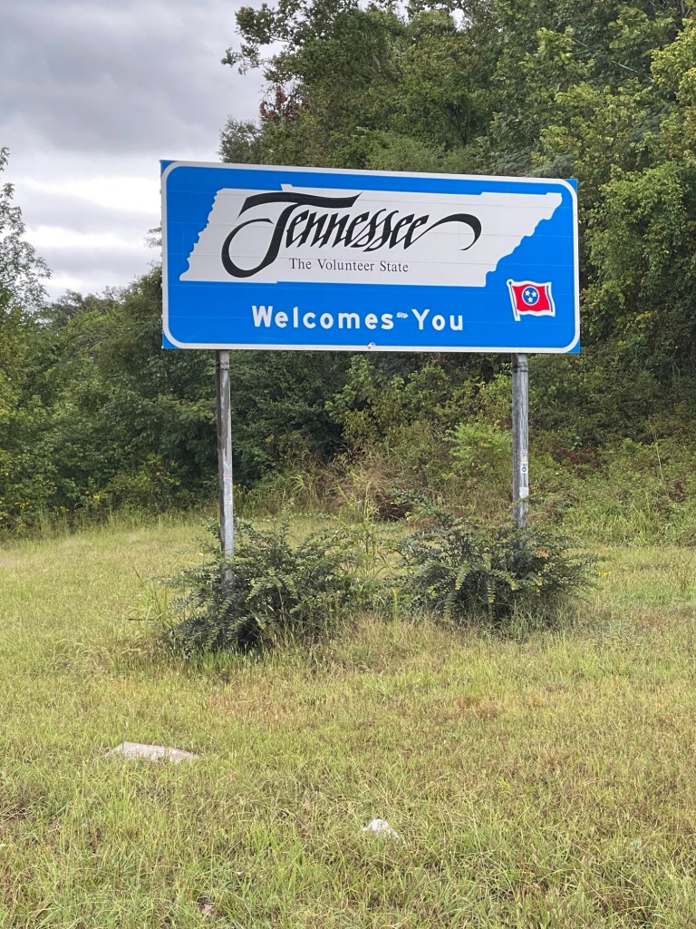
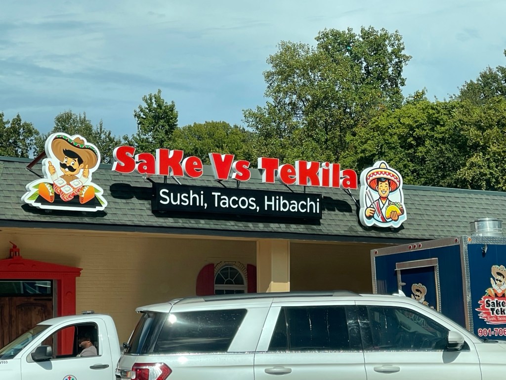
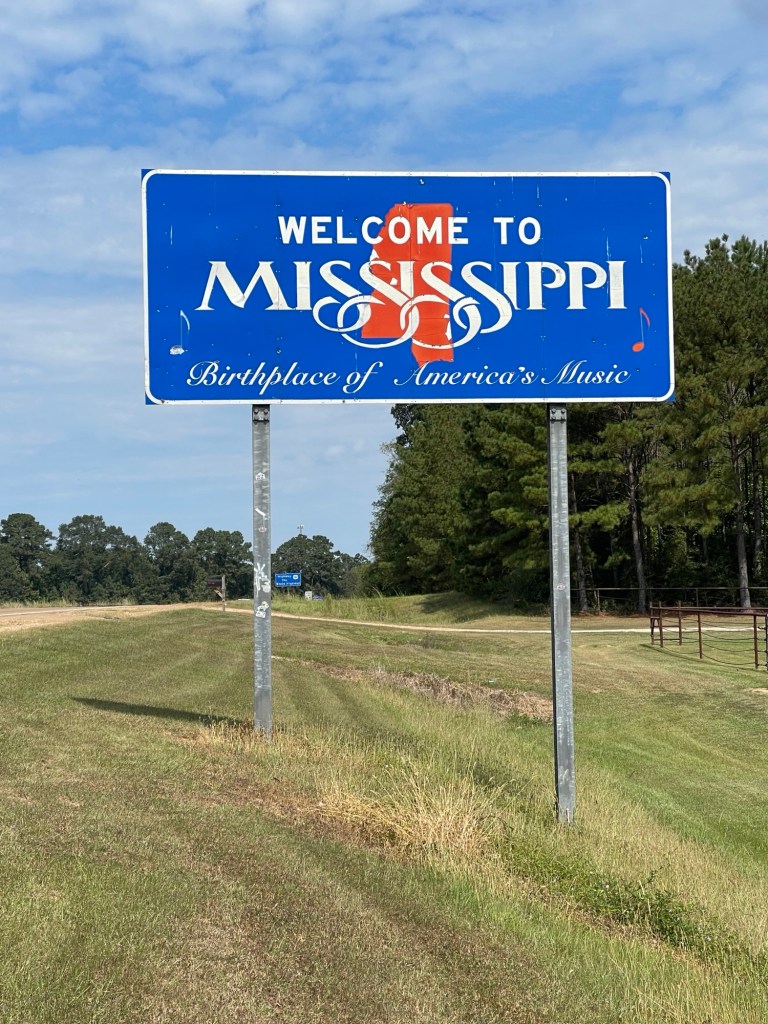
After that it was a more or less routine drive the rest of the way out of Mississippi. But finally some hilly, winding roads for a bit. Crossing the border into Tennessee brought me shortly into Memphis. The route zig zags through downtown Memphis and by either the third or fourth sign I lost track of the signs and the list of turns that I had jotted down, so I eventually I just decided to head north out of the city and find US-51 which would take me the rest of the way to Dyersburg. US-61 joins I-55 and crosses over to Arkansas at Memphis. Leaving Memphis, the Great River Route leaves US-51 for some backroads nearer the river, however as it had been raining most of the day, I opted to just stick with US-51 all the way to Dyersburg. About three o’clock I finally decided I’d stop and grab something to eat since I skipped breakfast. Found a nice BBQ place outside of Munford, TN called Outlaw BBQ. Had their pulled pork with a spicy sauce along with green beans and cole slaw. Taht was tasty!
Welcome to TennesseeGood lord Tennessee, what is this?
The hotel I was in didn’t have breakfast on the weekend or at least Sunday – huh? Whatever, I got going a bit earlier and was out the door about 8:15 headed north on 22 towards NOLA. Stopped for a quick breakfast and was on the road right around 9.
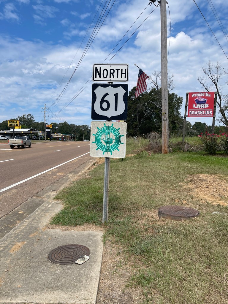
My destination today was Vicksburg, MS. Looking at the normal routes it is about a four to four and a half hour drive. Experience from the past couple of days would have me believe sticking strictly to the Great River Road would likely add 3 hours to the trip. Frankly I’ve seen enough of levees for a few days.
Therefore, I cheated a bit today. Once I crossed the river I instead got onto US-61 which is the bulk of the route anyway. So basically I just skipped all the curvy bits between NOLA and Baton Rouge. 61 is still a US highway so goes through towns and subject to stop lights etc. so I think was the right balance for today.
I made it to the Mississippi border just before noon and made it into Vicksburg about 2:15.
At the border Yes this is the right roadFirst one I’ve seen – and it’s closed 🤣
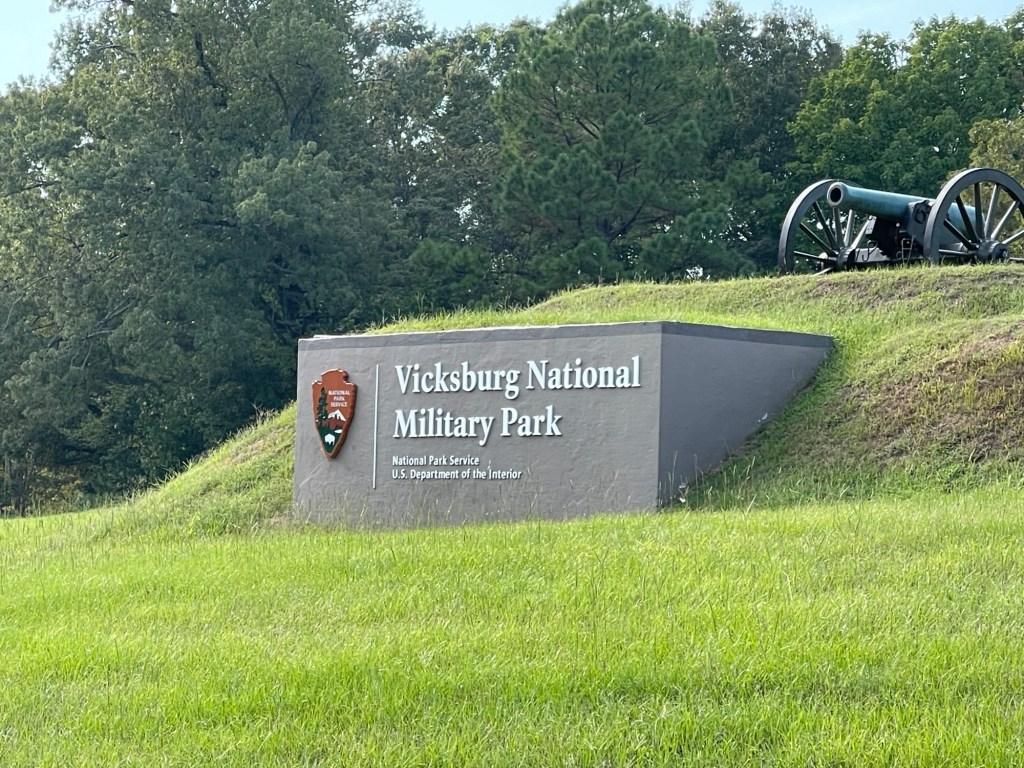
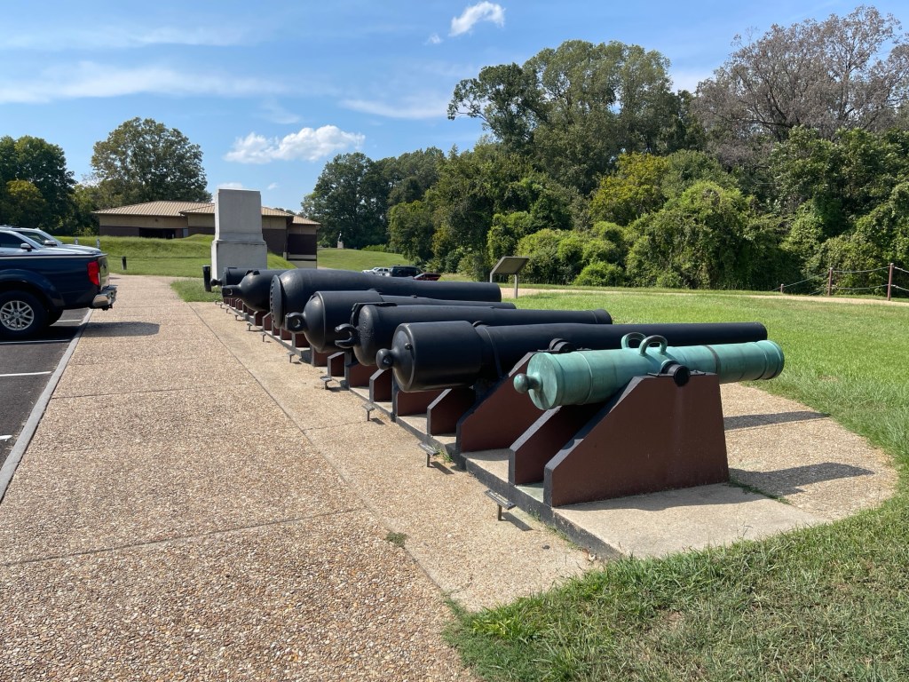
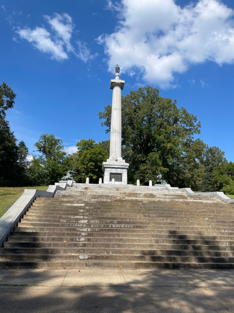
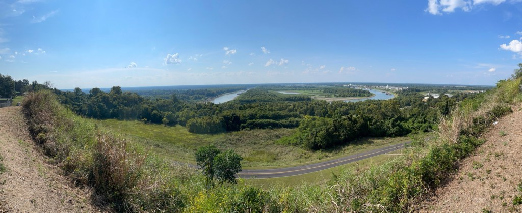
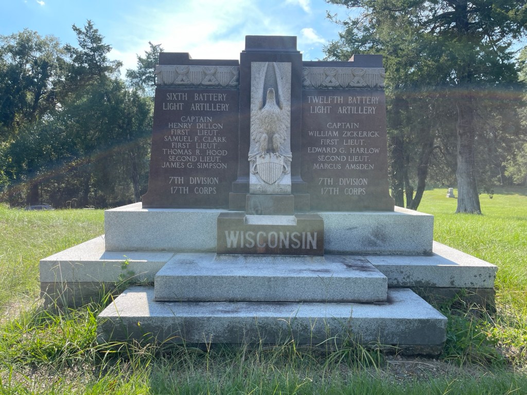
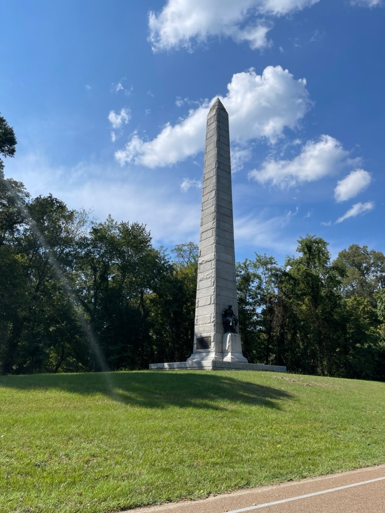
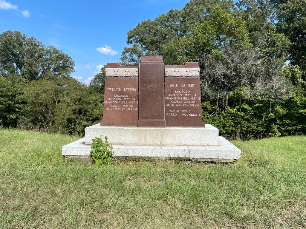
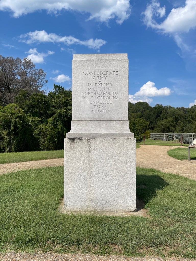
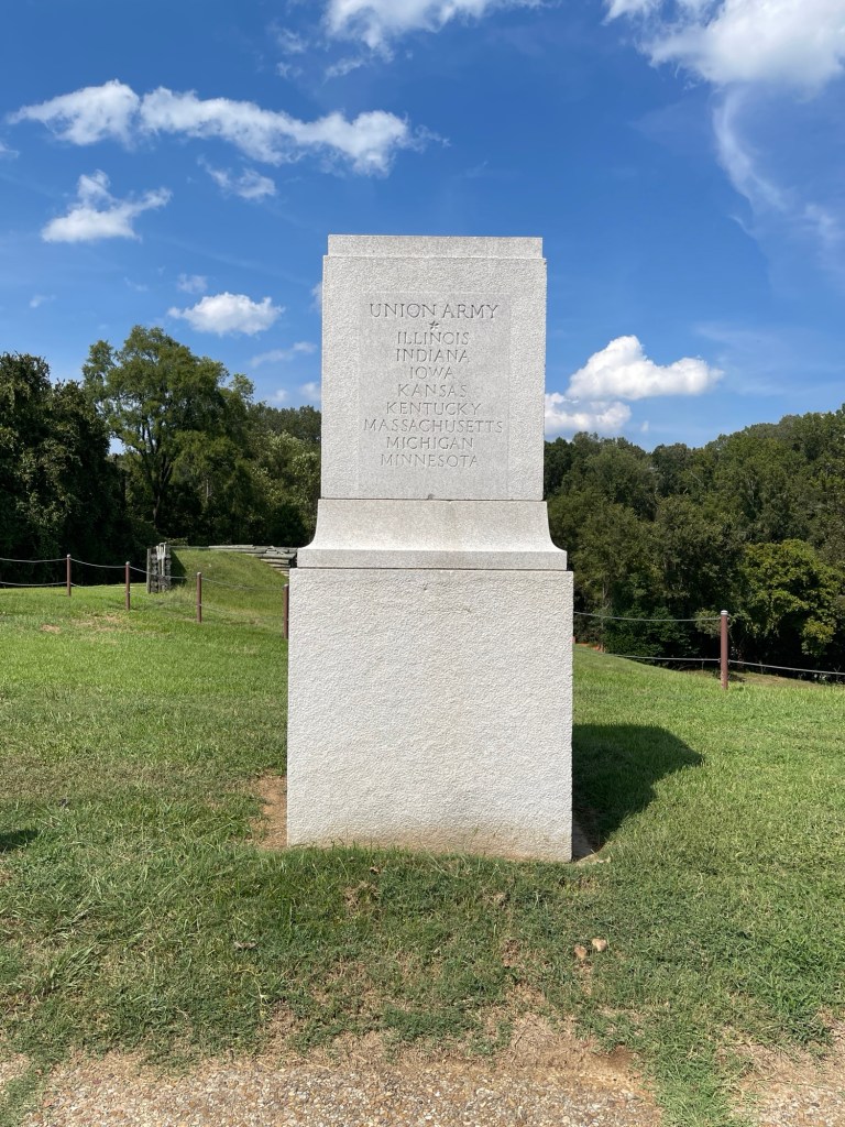
The reason I planned to stop here was to visit the National Military Park dedicated to the battle and siege of Vicksburg. You could certainly spend considerably more time here but a couple of hours was enough given the 90F plus temperatures. Was very interesting.
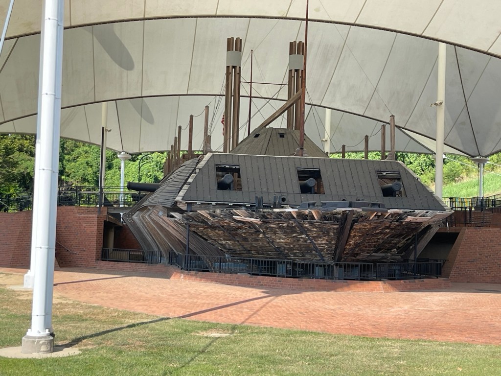
Additionally the park is home to the U.S.S Cairo an ironside that was sunk in 1862, found in 1956 and raised in the early 60s. Amazing to imagine living aboard one of those – I can only imagine how hot, humid, stuffy, and loud that must have been!
After that I checked into the hotel nearby and then headed to dinner. Had a seafood boil with shrimp, crab, potatoes, and corn. Delicious!
Plan for tomorrow is to reach somewhere in Tennessee but still need to review the route tonight.
Today marks the final leg to the end of the road, and near the end of the river. As it is the weekend, a didn’t get going too early today. After a quick breakfast, I got on the road about 9:40. Again I had reviewed the route and had a list of all the highways that I would be needing to look out for. Heading south out of Vidalia, the roads more or less follow the river and the roads are up along side of or in some cases almost on the levees. So while more or less flat they are nice and winding to keep things interesting.
The cotton fields pretty much changed exclusively to sugar cane. Lots and lost of sugar cane. And the occasional other things that I could not identify. Case in point, at one point I had to let up on the gas as there was definitely something in the road ahead. Had to stop and let them turn into the field.
Otherwise it was just a slow winding trip around the levees. The list of roads held up well, except for two cases. One involved a sign associated with the Great River Road pointing down a highway that was not on my list. I took the turn and followed a few miles until it reach an intersection with dirt roads going in three directions and no clear sign – though I was pretty sure which way would be correct, I opted to backtrack and continue on my merry way. That worked and the signs returned.
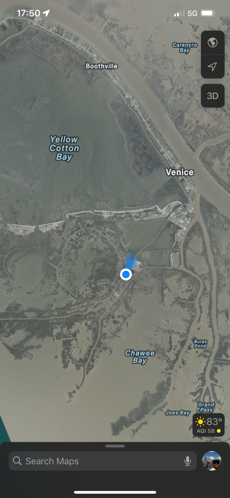
The other bad luck was a missed turn as I was entering New Orleans proper and instead of making the correct turn I took the next turn which ended up being a bridge across the river. Not exactly where I wanted to end up, but in any case I just had to recalculate and probably only added a half hour to my route before I got back on track. Once through the city it was the final stretch of about 70 miles down highway 23 to Venice, LA.
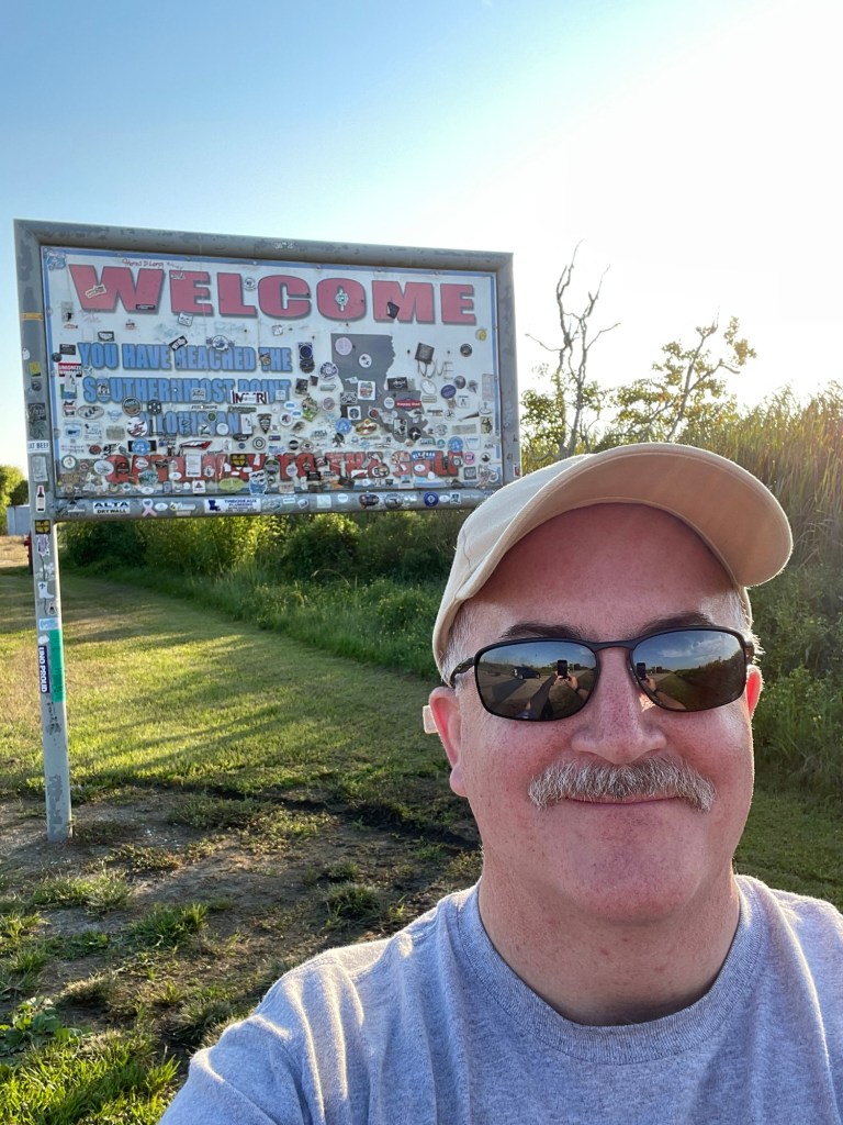
And then I was there, the end of the road. Seriously, this is it?
Southern most point.Woohoo!?Whole lotta water and a bit of dry land
In all honesty, I didn’t know what I was expecting. But it didn’t include a dumpster and miscellaneous equipment laying around. There is really just a whole lot of nothing once you get down here. Technically the highway 23 route ends a little early, and then you can drive a little further to reach this point. But they don’t even mark it as the start or end of the route so the whole thing is a bit anti-climactic. Maybe a little park or something with a view of the river, I don’t know. Anyway, this truly is a case where the journey is the destination.
I spotted a hotel just south of Belle Chasse on the way down and while stopped at the southern end, I booked a room there. Was about a 45 minute drive back and I got there right around 7pm. Been a long day on the road. Found a cajun\creole restaurant called Zyedeco’s just a few minutes up the road. Had their crabcakes and a side of jambalaya – yumm! Then back to the hotel and getting this writing finally up to date!
Crabcakes and jambalaya
Tomorrow the trek back north starts. Will be traveling up the east bank and tomorrow’s destination is Vicksburg, MS.
I had reviewed the route to Vidalia, LA last night and planned to get on the road about 9am which would put me there around 4pm. Went to have some breakfast around 8, back to the room about 8:30, pack up some stuff, showered, got dressed, finished packing, ready to go! Opened the door to pouring rain… Huh? Had not expected that! Looked at the phone, yup – big thunderstorm, flash flood warnings, rain for next 45 minutes. OK, guess I’ll do a little work stuff.
Two hours later, still raining. Time for checkout anyway, so packed up and loaded things into the car. Drove down to McDonalds and sat in the parking lot for about 45 minutes working on the past days blog entries. Finally stopped raining about noon. Ran inside for some lunch and then was finally on the road about 12:30.
The route from West Helene goes south into a big bend in the river and within this bend are a couple of bayous that run in parallel from north to south. It had rained a lot and there were flash flood warnings until 1:30pm so I was actually a bit nervous heading in this direction. But, the route is the route, so – onwards!
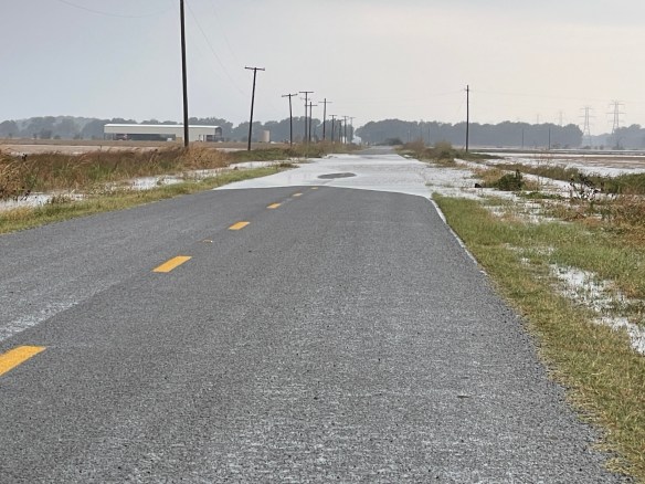
As mentioned, I had reviewed the routes so I knew which highways I was looking for and more or less the order. So as I headed south out of West Helene I was looking for state highway 418 which came up earlier than I expected so I actually missed the turn. Not a big deal, not much traffic, so it’s easy enough to pull a u-turn. Turned onto the road, and oh my, it’s narrow, and no shoulder. Hey, at least it’s paved and I mean it is a state highway. Oh look, there’s some standing water on the edges. OK, no big deal it’s not much. Always onward. Well, now it’s a bit on both sides, I’ll just scooch on down the middle, no problem. Onward…? Just take it slow. OK, what’s this? Well now, that seems kinda deep and all the way across and a bit long. Oh hell no! Reverse, 3-point turn, photo, and it’s back the way I came. Routes are only suggestions!
Nope, nope, noppity, nope! I will find another way.
Now, I probably could have made it through that stretch of water, but I just didn’t think it worth the risk and I had no idea if there would be even worse sections. As mentioned this was a bayou area so its inherently wet, low-lying land and it had rained a lot! After backtracking and checking the map it turns out that this highway 418 does a loop and I was actually supposed to pick it up further south, deeper into the bend of the river and I assume even lower-lying. So I’m pretty sure I made the right call. I back tracked and picked up the route on the other side of the bend in the river and stayed high and dry the entire way!
Ok, by dry, I only mean that I wasn’t dodging standing water on the roads. It did continue to rain off and on throughout most of the drive. But all in all it wasn’t too bad. Other than being kind of a boring drive with nothing much to see but cotton fields. I’ve now arrived in Louisiana for the first time ever!
First time in Louisiana!
I arrived in Vidalia about 6:30 and had been considering camping here for the night as I had found a campground that was right on the river that looked pretty decent and while still hot, the nights had been cooling off decently so thought it would be a good option. Unfortunately when I pulled into the campground, I found that the office closed at 5pm and there weren’t any clear instructions on being able to self register. Oh well, I wasn’t that set on camping and there were a few hotels just up the road as well. So I checked into one and got a nice riverside view.
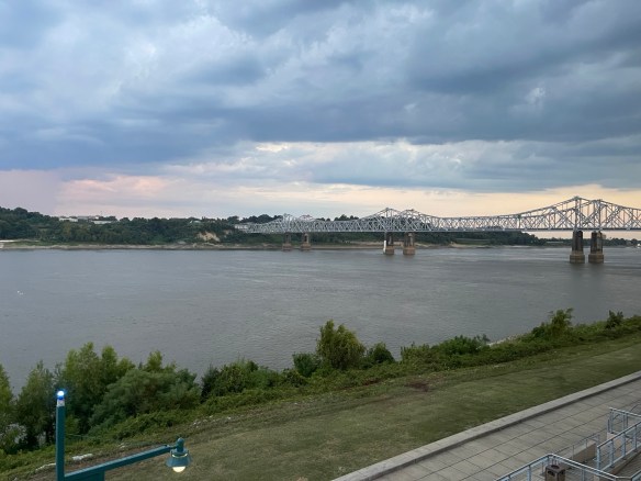
Natchez, MS across the river from Vidalia, LA
Reviews of the few local restaurants were less than stellar so I opted to just have dinner in the hotel restaurant. Pretty quiet there, one couple just finishing dinner and a couple people at the bar. Bartender and cook the only ones there. So I pulled up a chair at the bar as well. Bob, the bartender, handed me the menu and led with “there are no steaks, even if it’s on the menu”. Well, OK, good thing I wasn’t planning on a steak. I was looking at the catfish\shrimp combo platter. When I told Bob that’s what I wanted he winced and said, “ooh, sorry no shrimp tonight either”. You’re killing me Bob! OK, just the catfish then. Fortunately it was good – I had it blackened. Then it was back to the room and crashing for the night.
Tomorrow is the last leg, all the way down to the end of the river and road!
Hot Springs NP is off the itinerary. After finally reviewing what there is to do there I decided it wasn’t worth two days off the main route. After initially considering driving all the way to Baton Rouge today I came to my senses and decided I would stop in West Helene, AR.
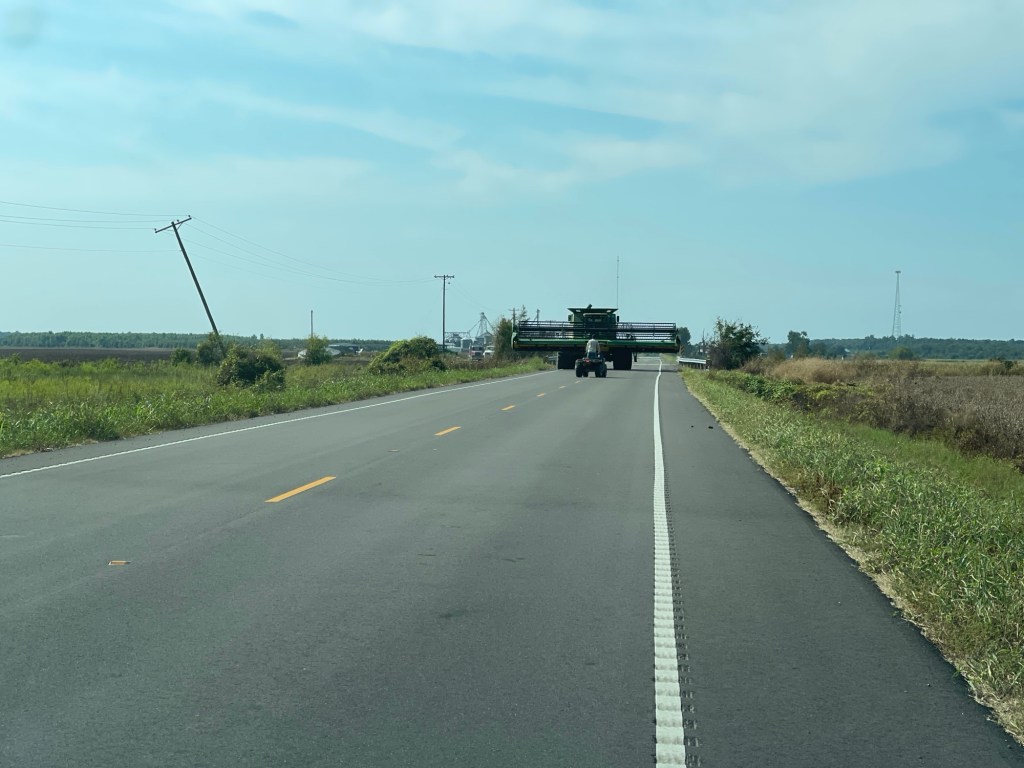
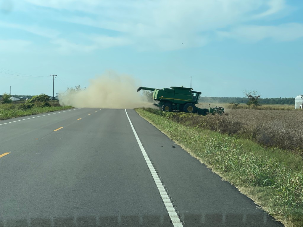
I also studied the route described on the wiki page so that I actually knew which roads to expect. For the most part the Arkansas signage seems a bit better than Missouri’s. It was a mostly uneventful drive, with flat straight roads going through many small towns. Oh, and lots of soy beans and cotton. The only excitement was north of Marion, AR when a truck driver apparently decided to pull out into the road without looking. Fortunately my brakes work just fine! Phew!
Arrived in West Helene about 3:15, shortest day on the road so far, and settled into the hotel. Finally started updating this blog. Eventually got hungry and went across to the Mexican restaurant suggested by the hotel clerk. Food was great but wow was the waiter slow.
Plan for tomorrow is to get to Vidalia, LA. which is just across the river from Natchez, MS.
So the flip side of my lack of planning for this trip is the flexibility that it provides. My tentative itinerary called for a drive to Jonesboro, AR today. However after reviewing the length of the drive compared to previous days I decided that was a bit too ambitious. Also, as I would be driving through St. Louis I might spend some time at the Gateway Arch, Instead I decided that I would stop in Cape Girardeau, MO instead. Sticking to the backroads hasn’t added that much mileage it seems but it does take considerably more time.
The drive south out of Hannibal continued with a few nice areas and made a couple stops for scenic views. That is until around the northwest outskirts of St. Loius where State Highway 79 would intersect with I-70. There was no clear indication, that I saw anyway, to get onto I-70. Looking at the GPS it appeared that a similar state\county road more closely followed the river so I opted to take that instead of getting on the Interstate. Again my lack of planning bit me here as the route does actually take the Interstate routes through the city. To further add to my confusion, the river that I was seeing on my GPS at some point was not the Mississippi, but rather the Missouri which of course joins the Mississippi above St. Louis…
In any case, it was around noon and I was hungry and annoyed at this point so I finally pulled over to grab some lunch and assess the situation from a stationary position. I was in St. Charles which is one of the northwestern suburbs of St. Louis. So from here I decided I would drive over to the arch which was only about a half hour drive and I assumed pick up the route again since I would be right on the river at that point. Yeah – don’t assume things!
I could have sworn the Gateway Arch used to be a National Monument, either my memory failed or it recently became a National Park. Getting into and navigating the downtown area is a pain. The last time I visited, in 2009, I know I parked right off the street on the river drive. But that know appears to be blocked off or at least very sneakily accessible. After a frustrating few minutes trying to find my way around – there is amazingly no apparent signage for the park (aside from many lots offering “arch parking”) I bailed! Having seen the arch before I didn’t need to spend any more time so I found the quickest way out of town on I-55 again assuming I would meet up with the route somewhere along the way.
After getting out of the city and heading south for about 15 minutes I was able to make my way back onto US-61 but saw no signs for the River Road. Finally after about an hour I think, the signs finally returned! Back on track officially.
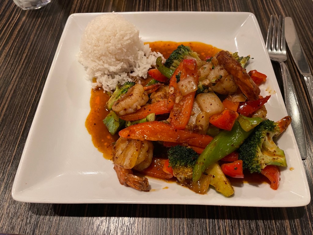
I arrived in Cape Girardeau around 4pm and checked into the hotel, settled in and relaxed for a bit. Checked the map for nearby restaurants and settled on a place called Bistro Saffron. They had a shrimp special with peppers, onions, and broccoli with just the right amount of heat. Very tasty!
Sautéed shrimp and veggies
The tentative plan for tomorrow has been to head to Hot Springs National Park in Arkansas. However, I’m starting to rethink that. We shall see what tomorrow brings.
After the fantastic drive yesterday from home to Dubuque, I wasn’t expecting it to continue so well. However, the destination today was Hannibal, MO and it did not disappoint.
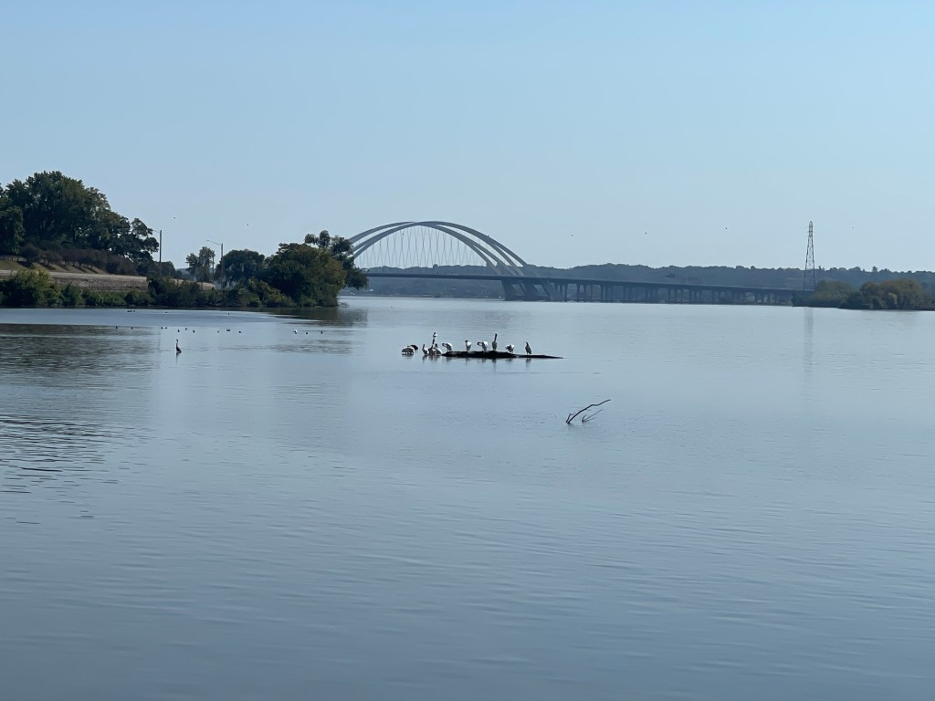
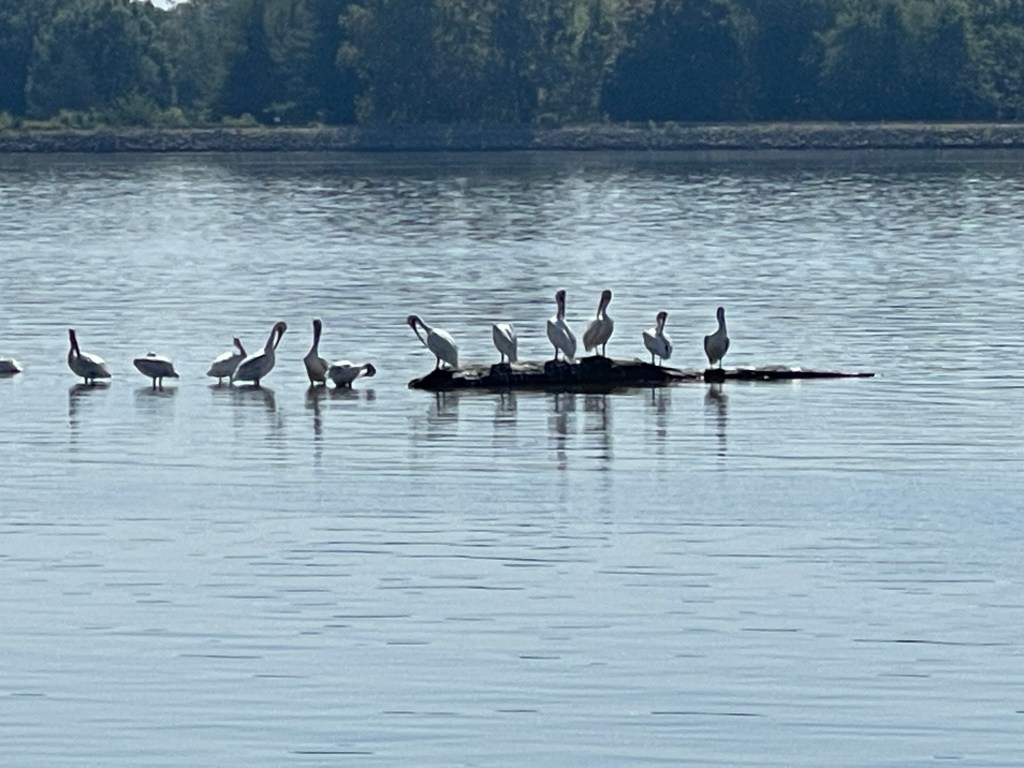
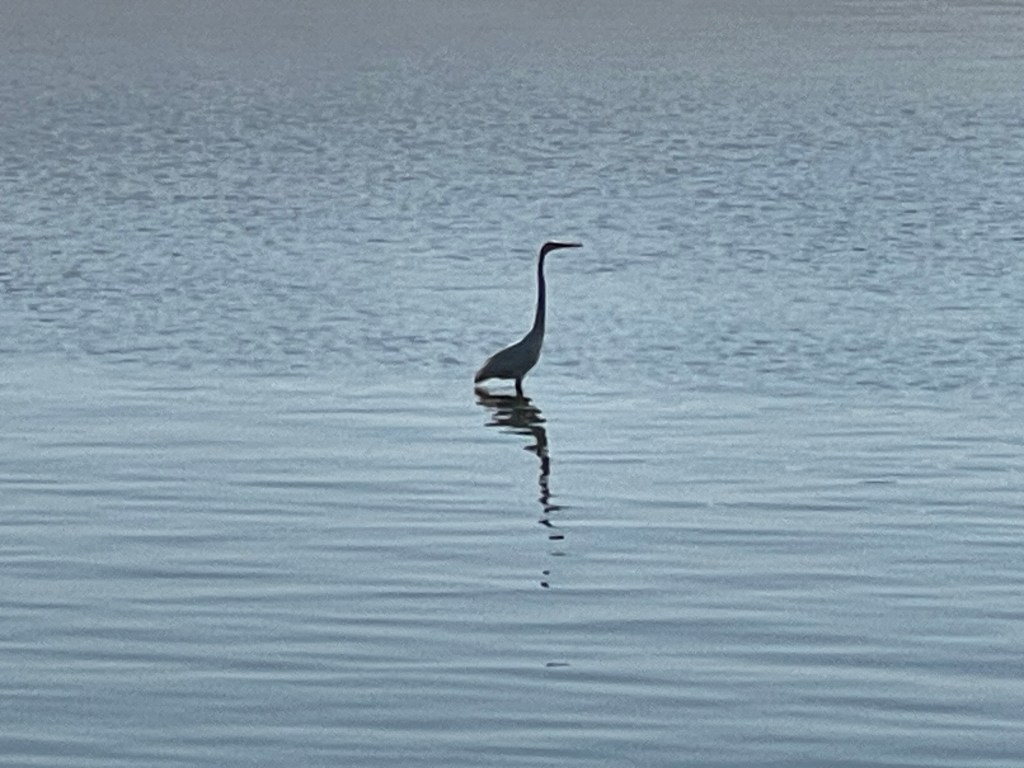
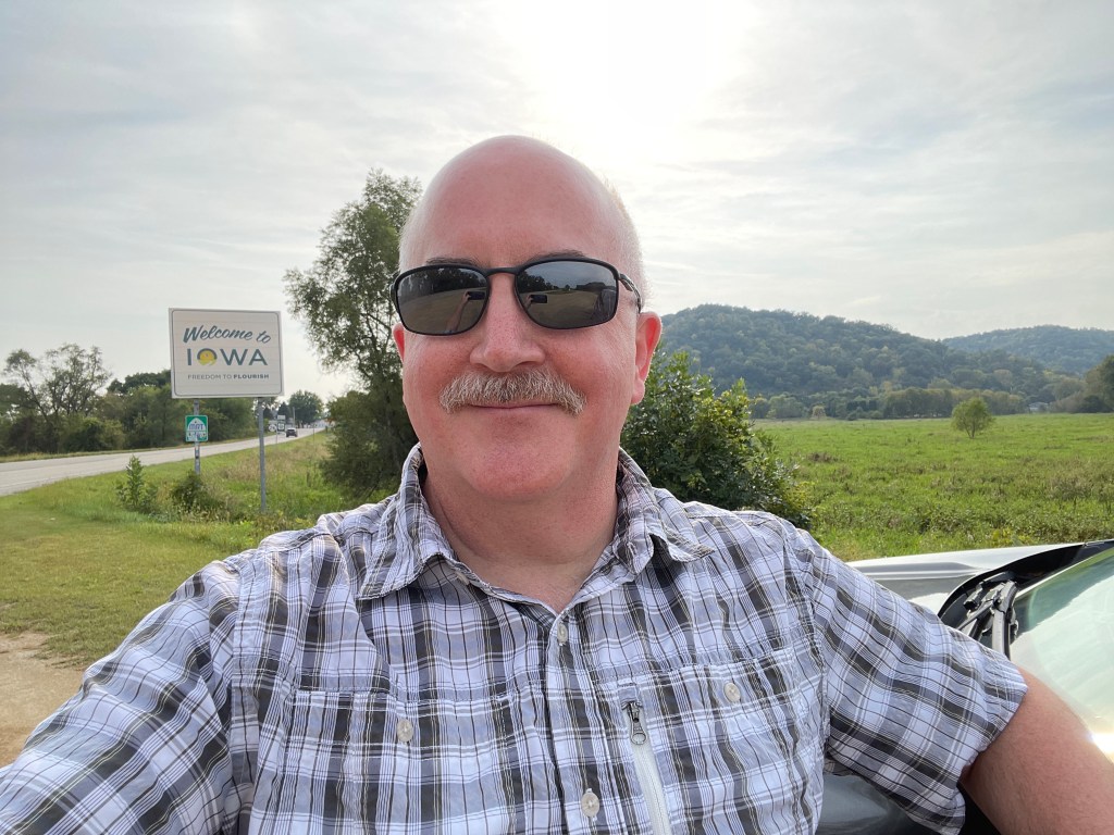
The drive from Dubuque into northern Missouri was almost as good as the previous days drive – almost. Made stops in Davenport and Burlington and a few other scenic stops. I found the Missouri signage to not be as clearly posted as it was in Minnesota and Iowa. Despite this for the most part it was good enough.
Davenport, IABirds of DavenportAnother bird of DavenportBurlington, IAThe Missouri signsNarrow lane along the riverNear Montrose, IA
There were just enough hilly, winding roads to keep it interesting. I passed one campground just north of Hannibal that was right along the river, however is was about 95 degrees and I had no desire to deal with camping though it did look like a nice spot. Anyway, last night I had scoped out a few hotels along the route and was able to get a room for the night. Unless it cools off in the next few days I’m pretty sure camping is off the table for the rest of the trip.
After getting settled into the hotel, it was time to find something for dinner. I settled on a place called The Brick Oven which is a local Italian restaurant since I was in the mood for some pizza. I ordered a side salad and their Garlic Lovers pizza which is made on a nice crispy thin crust, with a garlic spread, caramalized onions, and sausage. It was fantastic! After that it was back to the hotel to relax and get some sleep.
Due to the quirk of the backtracking route to home on Day 1, Day 2 of the road trip starts from home again. Again, due to my lack of planning I had a few things to organize in the morning, get everything loaded into the car and a few work things to address. With those things going on I decided I would get on the road around 1pm. My destination for the day was Dubuque, IA and I decided I would just use some hotel points rather than trying to find a campground on short notice.
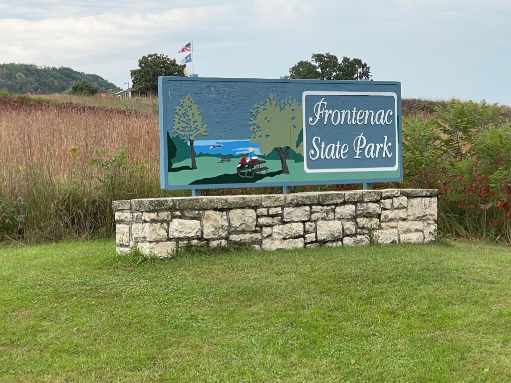
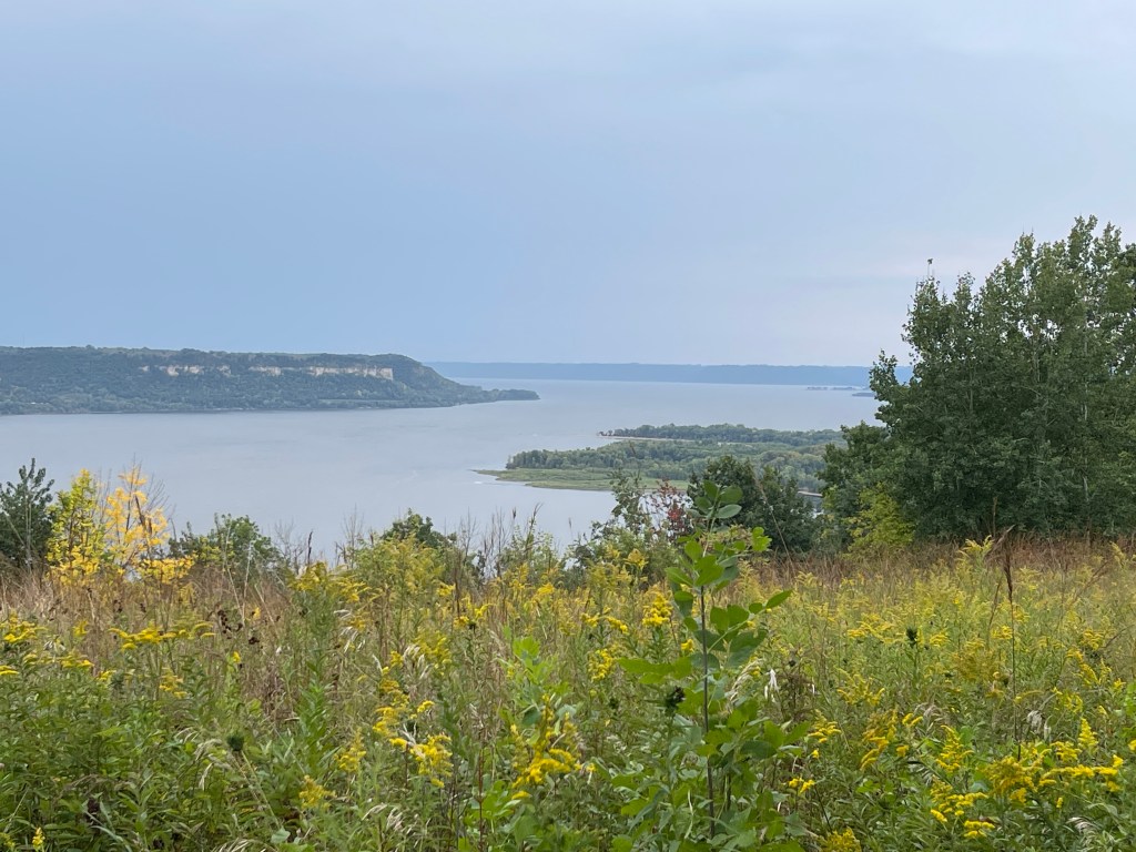
I did in fact get on the road about 1:30. Headed just a few miles down the road from the house to access US Highway 61 which would take me a good junk of the way in the coming days. It’s been awhile since I’ve driven south on US61 and never all that far. The drive is nice through Hastings and Red Wing and on to Lake City. But from that point on, all the way to Dubuque it is truly stunning. Hilly, winding roads, little traffic, it was truly a joy to drive even in the Edge. The Solstice would be a lot of fun. I might take a day trip down this way in a few weeks when the leaves start to change – it must be spectacular.
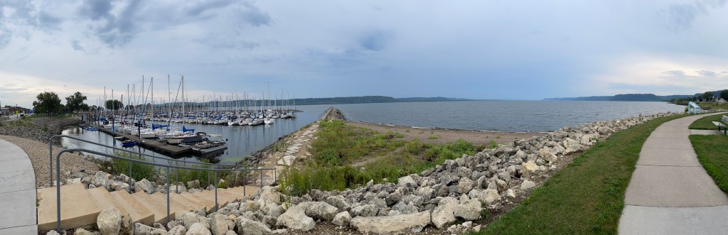
I made a few stops along the way for some scenic overlooks but mostly was just a nice drive and a beautiful day for it other than a brief bit of rain around Winona. I arrived at the hotel in Dubuque around 7 pm and got checked in. Despite the hotel being on an island in the middle of the river, there weren’t any views of the river. Oh well. Plan for Day 3 is to reach Hannibal, MO.
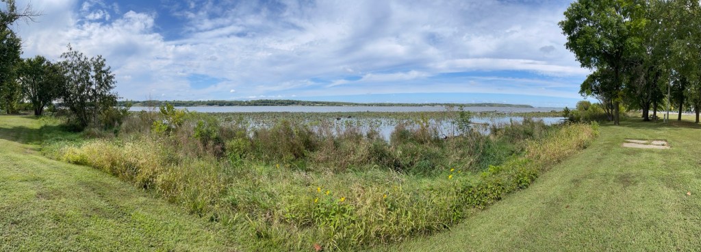
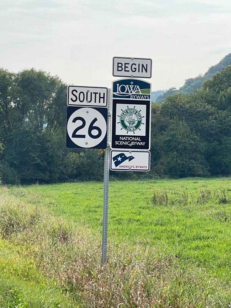
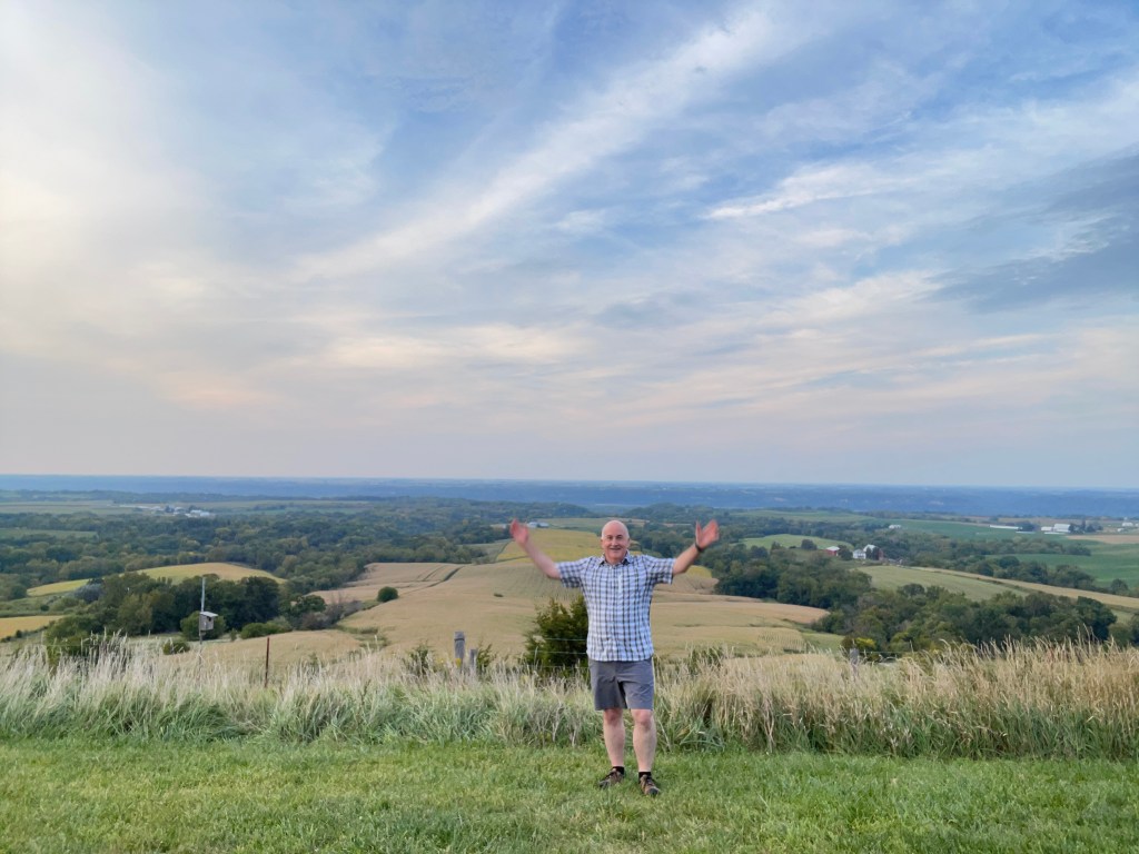
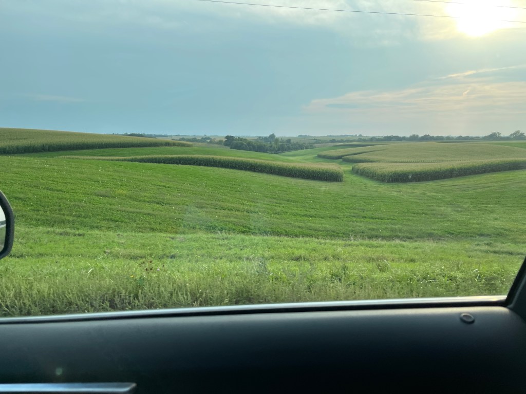
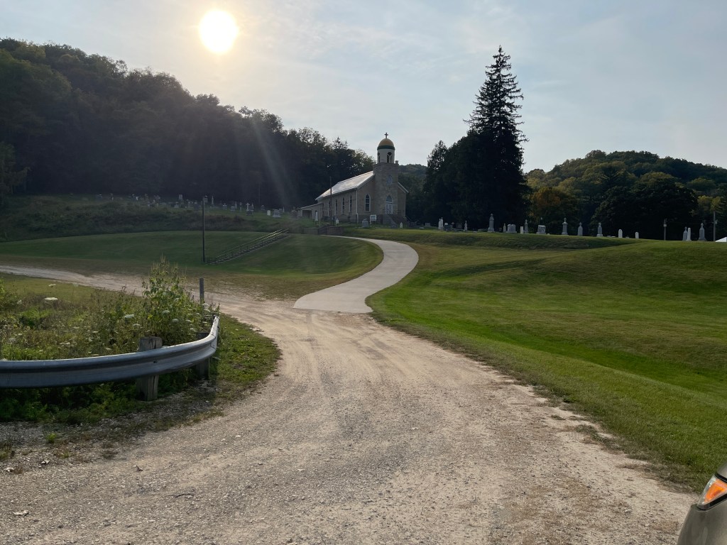
Frontenac State Park EntranceLake Pepin from FrontenacLake Pepin at Lake CityWelcome to IowaThe National Route ContinuesSomewhere in IowaCorn, lots and lots of cornPeaceful valley church in Iowa