EclipseTrip2017 – Day 2

Well it ended up raining a good bit overnight. The constant pattering on the tent made it hard to get to sleep. Woke up about 6:30, broke camp, showered and opted for the buffet breakfast at the camp kitchen vs. cooking something myself. Was on the road about 8:30.

Plan was to drive to Casper, WY and find someplace to stay. I planned a stop at Scotts Bluff which is a National Monument to the pioneers on the Oregon Trail. It was one of the best known landmarks in the area. I drove to the top and stretched my legs on the short trail. Then back in the car.

I had been mulling over what to do for the evening; park at a rest stop, or go to a late movie and perhaps park at a Wal-Mart when I passed Glendo, WY and saw a little tent city. I stopped at a rest area about 15 miles north where a bunch of people had already setup camp as well as another little tent city a short distance down the hill. I checked the map and the path of totality goes right over Glendo and the forecast looks good there as well. So I called another audible and abandoned the Casper option.

I drove back down the interstate to Glendo and got a spot for the night. 20 bucks to just sleep in the car, 50 bucks to pitch a tent. I’m sleeping in my tent. Was all settled in about 5 pm. Should be able to get some sleep tonight and be ready for the big event in the morning. And staying here means an hour less driving tomorrow!

Now time to make some dinner!

Day 11: Cedar Breaks National Monument

I departed Cedar City for Cedar Breaks National Monument which was my last planned destination in Utah.  The direct route out of town was not an option as the road was closed due to a “massive rockslide”.  So the GPS thought I should take a dirt road over the mountain – uh, no thanks.  I kept going a bit further until I found the alternate paved road.  It was a fun drive that climbs about 5000 feet in about 20 miles.

DSC_0005

The Cedar Breaks is an isolated version of the same type of formation at Bryce Canyon.  It’s a single amphitheater that is about 2500 feet deep and 3 miles across.  It’s located at just over 10,000 feet and there is still snow present as seen in the picture above.

From there I headed up to Evanston, Wyoming where I’;m spending the night.  The plan was to head to Grand Teton tomorrow.  However, I knew from the beginning that the back half of this trip was going to be a bit dicey given the time of year and the locations.  Looking at the weather for the next few days in Grand Teton shows snow/rain mix which is not a good idea with the Solstice and a trailer.  It’s also forecast to be raining at Devils Tower.  So, I’m pulling the plug on both of those and just heading for home.  Probably to Cheyenne tomorrow, then Omaha and home on Friday.

Day 6: Will Wonders Never Cease?

Today I had planned for a leisurely drive from Moab over to Bryce Canyon National Park.  But as mentioned in my last post, the photos from Canyonlands were more or less garbage, so I decided to make a run through the park to at least capture some highlights.  Now I was driving right past the turn-off to the park anyway, but this is about 25 miles from the park plus the additional perhaps 10-15 miles out to the Grand View, so we’re talking about a 70-80 mile side trip plus time for photos – so all in all about 2 and half hours.

Then during this time, I also had the thought that I should run back up highway 128 and film it in real time as opposed to the time lapse I already had.  Besides, you always see different views from the alternate directions.  I had to get back up to I-70 to get to Bryce anyway so what the heck.  So after doing these things it was about 1 o’clock and I still had the original 5 hour drive to go.  Good plan.

Now, while I knew that my route was going to take me near Capitol Reef National Park and Grand Staircase-Escalante National Monument, I did not realize that I would in fact be driving through them.  Bonus!

Of course, this is the down side of simply relying on the GPS and not digging into the routes as I have done on my previous trips.  In hind sight I would have planned to stay a night in Capitol Reef as it is about mid-way on this drive.  But, oh well.

There is a scenic drive of about 10 miles (one way) that I had to take – so that killed another hour.  After this I then entered the Dixie National Forest which offers overlooks of Grand Staircase.  Then I entered the actual monument – simply unbelievable.

DSC_0269

I stopped for a few photos and am hoping that my driving time-lapse will show a little bit, but this is something that I don’t think photos can really convey.  You have to drive this route to believe it.  It is hands down the most amazing drive I’ve ever taken.

After all of these “delays”, my leisurely day ended with my arrival at the campground at about 7:30pm.  I got the tent up despite the wind and then went into “town” because I didn’t want the hassle of cooking in the dark and wind.  There are two restaurants in Cannonville – a pizza place and Clarke’s.  I chose Clarke’s since they were open later – 9pm.  Had a very nice Rainbow Trout dinner.  To top it off they had The Piano Guys playing on their sound system – I love those guys!

I’m here through the weekend now, so no more serious driving ’til the middle of next week.  Now I’ll just enjoy Bryce Canyon!

Muir Woods

Well, I’m in San Jose this week for work.  I flew out on Sunday morning in order to visit Muir Woods National Monument which is a short drive north of San Francisco.  I arrived around noon, grabbed some lunch and then found the Muir Woods shuttle bus.  The park has very limited parking and with its proximity to the Bay Area it fills up early, so the shuttle is perfect, and for 3 bucks round-trip you can’t beat it.  The shuttle takes a slightly different route than cars as the car road is apparently a bit too twisty.  Even so, the route the shuttle takes is like a roller coaster!  The bus route gives you a glimpse of the ocean (Muir Beach) and then it’s up into the woods.

The monument is actually located in the center of a California State Park and it offers an easy 2 mile loop hike along a stream through the woods and access to numerous other trails.  I visited on a beautiful Sunday afternoon so there were lots of people.  It’s quite a magnificent place to take a stroll with all of the enourmous trees.  There was a pair of deer enjoying the day as well.

Definitely worth the visit!

Day 19 – Craters of the Moon

As hoped with the adjusted schedule from yesterday, I was able to get rolling just after 7 this morning which got me to Craters of the Moon National Monument just after 9 in the morning which was at least two hours earlier than if I had camped in Mountain home as planned.

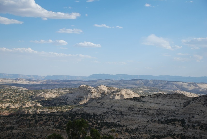
Craters of the Moon is an area of the Snake River Rift valley.  This region was formed as the continental crust drifted over a hot spot in the mantle.  Yellowstone is currently over this hot spot, hence all of the geological and geothermal activity there.

The entire region is covered with cinder cone volcanoes of various ages and sizes and lava, lots of lava.  Everywhere you look there is lava of one sort or another.  There are even lava tubes that have opened up and are now caves.  A few of which you can get into and explore.  I just went through the biggest (and quickest) as I didn’t want to spend the whole day here – though I easily could have.  All in all it’s a pretty interesting place.

As this was really just a travel day and CotM happened to be along the way I wanted to stop.  But after three hours it was noon and I had seen most of the highlights of the park, so it was time to roll again.

I got back on the road headed for West Yellowstone and my campground, but after only about 45 minutes I came across a sign advertising EBR-1 Historic site and since I had just entered an area designated as the Idaho National Laboratory, I was intrigued.  I followed the sign down the road, only a mile out of my way, and found myself at EBR-1. That’s Experimental Breeder Reactor #1, the world’s first nuclear power reactor.

It first went online in 1951 and was decommisisoned in ’64 and is now a national historic site and you can tour the place.  So I did.  Pretty interesting stuff.  The best factoid is that the word scram – as in to shut something (a nuclear reactor for instance) OFF quickly is an acronym.  Seems the Manhatten project reactor had a sophisticated emergency system – a guy with an axe would cut a rope which would release a control rod into the nulear pile.  Hence; Safety Control Rod Axe Man – or SCRAM.

I’m always amazed at what sort of things our government and military were willing to consider during the Cold War – especially the early years.  Turns out there was serious investigation into developing nuclear powered…

wait for it…

Aircraft!

They actually went so far as to build actual test engines.  The idea never went too far, they realized advancements in conventional jet engines were surpassing their experiment.  Not to mention the safety concerns about nuclear reactors flying around and possibly crashing or being shot down.  Of course they did crash one or blow it up or something to prove that it would be safe.  I feel safe, don’t you?

After about an hour there, I saw all there was to see and headed off for some lunch and the rest of my day’s drive.  I made to West Yellowstone and one of the nicest KOA campgrounds yet.  It would be perfect if the WiFi worked at my actual campsite, but that’s the only complaint.  Not too bad since I’m supposed to be camping!

Day 10 – Another driving day

Today was another planned driving day to get me from Ely, NV to Mammoth Lakes, CA.  Mammoth Lakes is a small resort town about an hour from the East entrance to Yosemite.  I wasn’t able to secure a campsite in the park so I’ll be staying at a campground on the west side of the park the next two days.

After driving all the way across Nevada, I didn’t want to have to deal with the potential traffic getting through Yosemite.  It’s at least another 2 and a half hours to the other side of Yosemite and I had been driving about six hours already.  In any case, the Devil’s Postpile National Monument is just a few miles from here, which is why I decided to overnight here.

I arrived and set up camp by about 4:30, finally grabbed a late lunch (there’s not a whole lot of civilization between Ely and here), and then hopped the shuttle to the Monument.  It’s an intersting geological formation related to an ancient lava eruption.  The history of the monument is also interesting; it was originally part of Yosemite but later removed from that park due to logging and mining interests.  It was then threatened to be dynamited in order to form a dam on the river and finally President Taft set it aside as a separate National Monument in 1911.  Glad they saved it.

Day 7

I spent Saturday at Dinosaur National Monument, which straddles the Colorado/Utah border.  The landscape here is absolutely incredible.  I took tons of pictures and hope to get some posted later tonight.

Unfortunately, the main attraction at Dinosaur, an active fossil quarry, was closed indefinitely on July 12, due to safety issues.  Apparently the building that houses the quarry was built on an unstable area of ground and has had problems ever since it opened back in the 50’s.  They were conducting some sort of inspection and determined that it was simply not safe to operate at this time.  So, I was a bit bummed not being able to see that, but the scenic drives and hikes were worth coming here by themselves.  Simply amazing.

That took up pretty much the entire day – I got back to my campsite about 4:30 and after having been out in the 95 to 100 degree heat all day I couldn’t just sit at my campsite.  If I had some shade I maybe could have managed it, but without any shade it was simply unbearable.  So, I went to another movie “You, Me and Dupree”.  It was a so-so movie, but the AC was wonderful and by the time the movie let out, it was nice and cool again.

Day 2

Day two began early – I was awake at 5 a.m. in anticipation of the shuttle landing, thinking it was at about 5:30.  Turns out it wasn’t until 7:15. Oh well, t was a beautiful morning.  The landing was exciting as usual.  Didn’t sleep well anyway as it was still about 90 degrees when I crawled into the tent and then the wind blew all night long, though it didn’t seem to cool things off any.

I rolled out of the campground about 9 o’clock and discovered that the Badlands entrance was just a few miles from my scheduled stop at the Minuteman site.  Since my tour wasn’t schedule until 1:30, it was the perfect way to spend the morning.  I took a leisurely drive through the Badlands park, stopping to take some pictures.  It’s an amazing landscape.  I can’t image being one of those early pioneers running into that mess in a covered wagon.

The Bandlands loop drive (westbound) ends up at Wall, SD.  I stopped at Wall Drug, but it was pretty much as I remembered, so I don’t think I spent 5 minutes there.  From there it was a bit of a backtrack, only 20 miles, to the Missile Site.  It was pretty interesting, but I think it’s clear what spending 24 hours at a time locked in a box prepared to destroy the world does to a person.  One of the Park Service Rangers who led the tour was a former Missileer, and he was just a bit odd.  Not that there’s anything wrong with that!

I pulled into the Mt. Rushmore campground about 6 and have my campsite set up, so I’m going to grab a bite to eat and then think I’ll head over to Mt. Rushmore – I think they still light it up at night.